Defense Geospatial Information Agency "Division General Constantin Barozzi"
Ministry of National Defense

Military Topographical Maps on a scale of 1:25,000 Stereo 70
Map type: Military topographic maps 1:25,000Product name: Military Topographic Maps at 1:25,000 scale

Technical details
2882
Map sheets
43
Maximum file size (MB)
2882
Map sheets
400
Scanning resolution (dpi)
Attribute table description
The attribute table contains the following fields:
| # | Field name | Description |
|---|---|---|
| 1 | Nomenclatură | nomenclature of the map sheet |
| 2 | Ediție | ediția foii de hartă |
Description / Method of acquisition
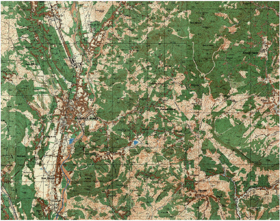
The topographic map is a detailed, conventional representation of the Earth's surface or a part of it in a horizontal plane, using a specific cartographic projection, generalized and reduced according to a specific scale.
The Military Topographic Map represents the transition to a new reference ellipsoid (Krasovski) and a new projection (Gauss-Krüger transverse cylindrical projection) due to national and international interests after World War II.
The task assigned to the Military Topographic Directorate to create a unified topographic map of the country at a 1:25,000 scale in a new projection, within a period of only 10 years, required finding and adopting solutions to accomplish this mission.
The map sheets measure 5' in latitude and 7'30" in longitude. The rectangular grid is drawn every 4 cm, and the geographic frame is marked every minute.
The contour line interval is 5 meters in lowland and hill areas and 10 meters in mountain areas. The accuracy of the map elements is 0.4 mm planimetrically and 1.25 m altimetrically in lowland areas, 0.6 mm planimetrically and 2.5 m altimetrically in hill areas, and 0.8 mm planimetrically and 5 m altimetrically in mountain areas.
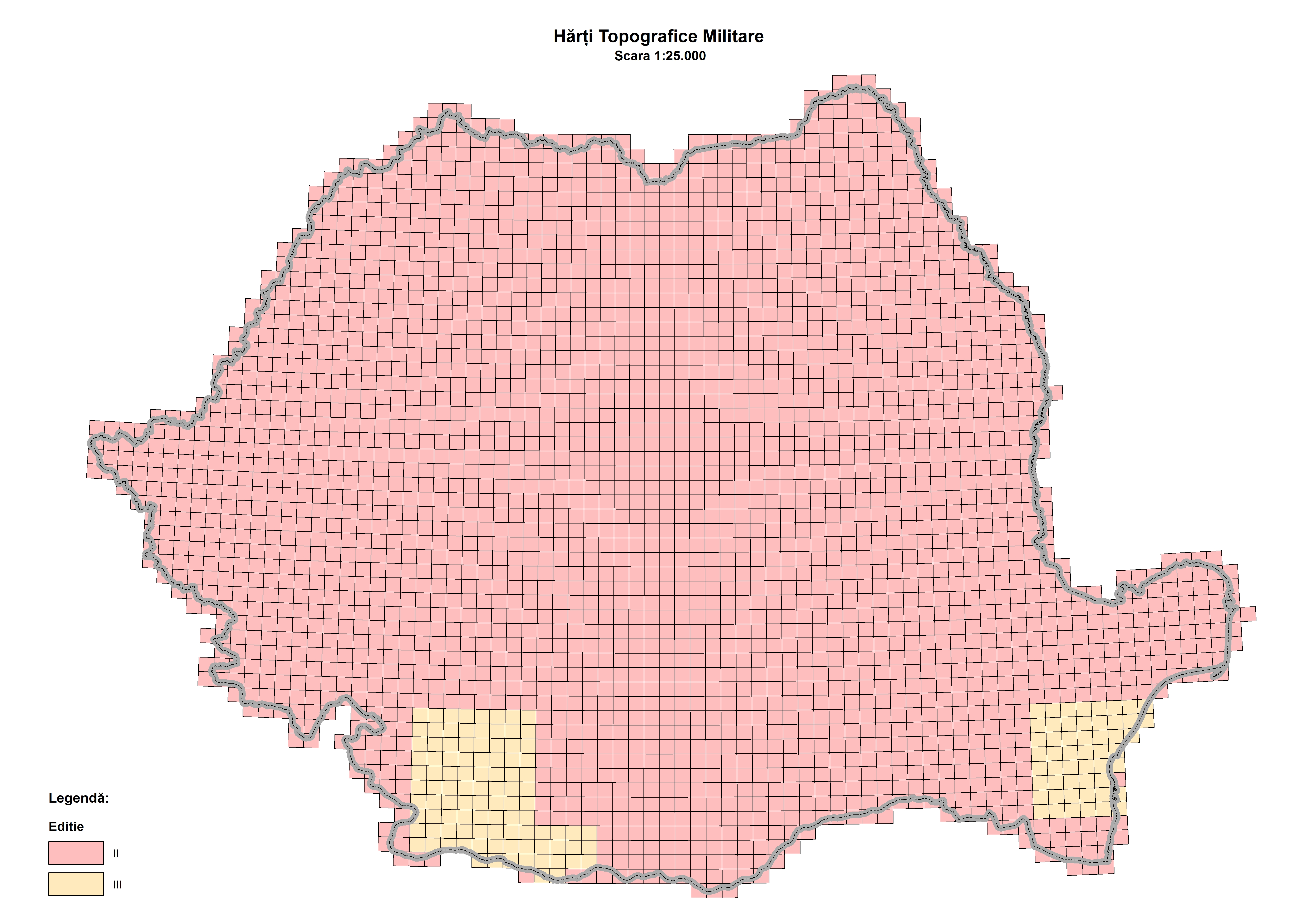
For the second edition of the 1:25,000 topographic map, data collection was carried out through aerial photography and topographic work between 1974 and 1978. The editing and cartographic process took place between 1974 and 1986, while printing was conducted between 1975 and 1987. Information for updating border nomenclatures was gathered from Bulgarian maps at a 1:25,000 scale (1957 edition), 1:200,000 scale (1964 edition), and Soviet maps at a 1:25,000 scale (editions produced between 1959 and 1974).
The third edition was created by updating the second edition. The number of updated nomenclatures is only 150 out of a total of 2,822 that were included in the second edition.
The operations carried out for this update consisted of field topographic work (1986-1992), editing (1990-1991), and printing (1990-1992).
Dataset
Atlas of Conventional Signs for Topographical Maps
Download Atlas of Conventional Signs for Topographic Maps [pdf]