Defense Geospatial Information Agency "Division General Constantin Barozzi"
Ministry of National Defense


Military Topographical Maps on a scale of 1:100,000 Stereo 70
Map type: Military topographic maps 1:100,000Product name: Military Topographical Maps at a scale of 1:100,000
Technical details
204
Map sheets
8
Color depth (bits)
43
Maximum file size (MB)
204
Map sheets
400
Scanning resolution (dpi)
Attribute table description
The attribute table contains the following fields:
| # | Field name | Description |
|---|---|---|
| 1 | Nomenclatură | nomenclature of the map sheet |
| 2 | Ediție | ediția foii de hartă |
Description / Method of acquisition
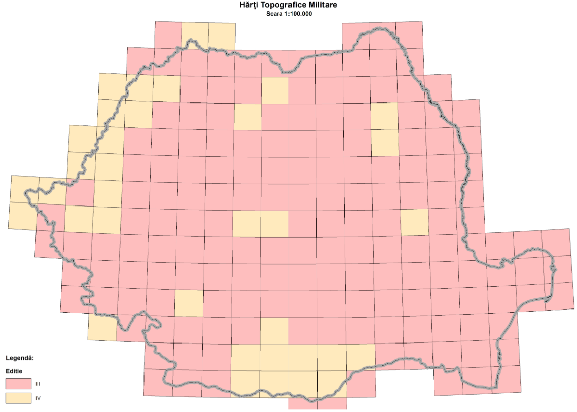
The 1:100,000 scale military topographic maps were produced in four editions through processes of generalization and updating based on the 1:50,000 and 1:25,000 scale maps, as well as through topographic surveys.
The map sheets measure 20' in latitude and 30' in longitude. The rectangular grid is drawn every 2 cm, and the geographic frame is marked every minute.
The contour line interval is 20 meters in lowland and hill areas and 40 meters in mountain areas. The positional accuracy of details and contours in relation to their length on cartographic materials is ±0.2 mm. The altimetric accuracy of contour lines in relation to the nearest base survey points does not exceed 6 meters in lowland regions and 4 meters in rugged areas with slope angles greater than 6 degrees.
The third edition is the last one produced at the national level. It was created by updating the third edition of the 1:50,000 scale topographic map and incorporating topographic surveys conducted between 1977 and 1990.
As with other products in the military topographic map series, this scale's edition remains incomplete. For this edition, field measurements were conducted between 1988 and 1994.