Defense Geospatial Information Agency "Division General Constantin Barozzi"
Ministry of National Defense


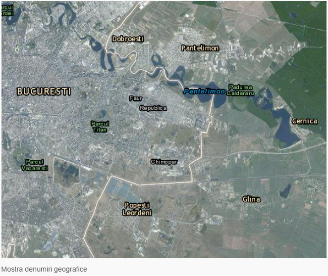
Geographical names
Map type: Vector dataProduct name: Geospatial data set with geographical names, INSPIRE theme I.3.


Technical details
The coordinate system in which they were created: Geographical, ETRS89
Projection: geographic coordinates
Format: INSPIRE
43
Maximum file size (MB)
Description / Method of acquisition
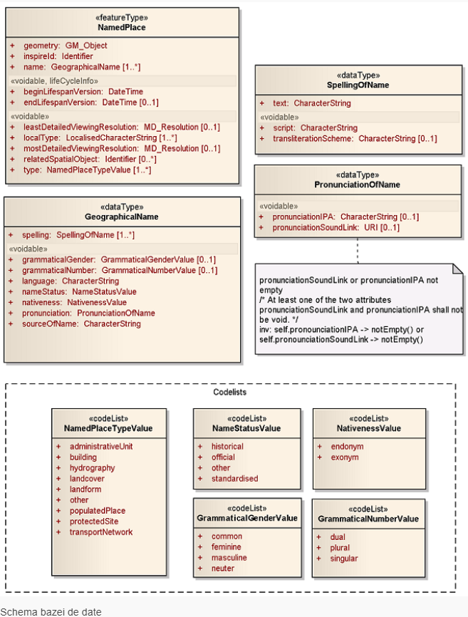
The dataset is derived from the Geographic Names Database for the territory of Romania, whose structure was designed in accordance with the requirements of STANAG 2213 IGEO, 4th Edition, and D2.8.I.3 INSPIRE Data Specification on Geographical Names.
To populate the geographic names database for Romania, information was collected from military topographic maps at a 1:25,000 scale. The geographic names gathered correspond to the following categories of geographic information:
- Administrative units
- Buildings
- Hydrographic features
- Land cover
- Relief features
- Settlements
- Protected areas
- Transportation network elements
- Geodetic/topographic points
Dataset
Content layers
The data set contains a single layer, whose fields are organized according to the data model specification of the INSPIRE I.3 theme, geographical names.