Defense Geospatial Information Agency "Division General Constantin Barozzi"
Ministry of National Defense


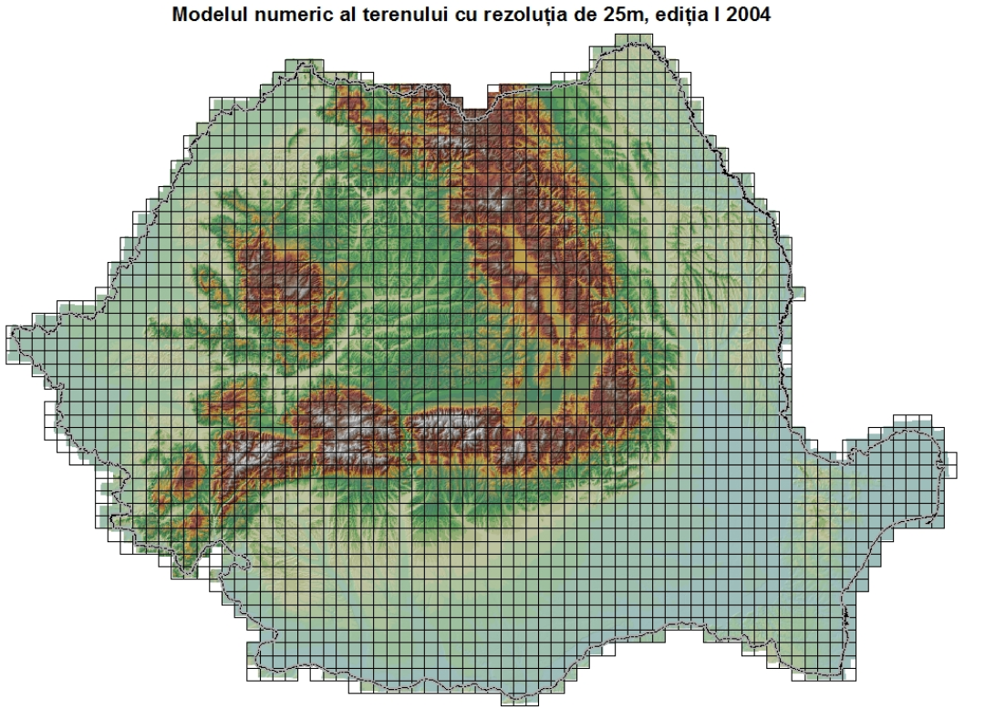
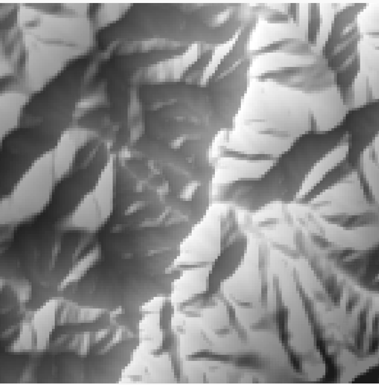
The Digital Terrain Model - DTED2
Map type: The Digital Terrain ModelProduct name: The Digital Terrain Model with a 25m resolution, Edition I (2004)
Technical details
The coordinate system in which they were created: The 1942 Coordinate System
Projection: The 1970 Stereographic Projection
Format: Uncompressed GeoTIFF with image pyramid in a separate file
2568
Number of sections
16
Color depth (bits)
395
Maximum file size (MB)
Description / Method of acquisition
The product has national coverage and was derived from the DTED2 (Digital Elevation Data Level 2) product, created by the Military Topographic Directorate between 1998 and 2004. The vertical reference system is the Baltic Sea.
The 25-meter resolution was obtained by projecting the original DTED2 data from geographic coordinates on the WGS84 ellipsoid into rectangular coordinates (1970 Stereographic Projection).
For the creation of the original DTED2 product, the following were used:
- Software: ArcInfo 7.0 / ArcView 3.3 / ArcGIS 8.3
- Source data: Editing originals (relief, hydrography) of 1:25,000 scale military topographic maps (second and third editions), a database with elevation points
The steps for obtaining the original DTED2 product were as follows:
- Scanning and georeferencing the editing originals of the 1:25,000 scale map sheets, created by the Military Topographic Directorate (D.T.M.).
- Vectorizing contour lines and hydrography elements (rivers, lakes), followed by assigning elevation values.
- Grouping the mentioned vector elements into 1° x 1° work zones (covering Romania’s territory) and creating TIN networks for each work zone.
- Generating a set of points in geographic coordinates on the WGS84 ellipsoid, with a resolution of 1 arc second x 1 arc second (approximately 26 meters), for each 1° x 1° work zone.
- Projecting the point sets into the Gauss-Kruger projection and interpolating elevation values.
- Estimating accuracy using the database with elevation points.
- Projecting the interpolated datasets back into geographic coordinates on the WGS84 ellipsoid and converting them into GRID format.
- Converting from GRID format to DTED2 format.
- Performing technical quality control.
Corresponding terrain dimensions for a section:
10 x 10 km
Altimetric/planimetric accuracy:
Varies depending on the terrain type (plain, hill, mountain). Accuracy estimations for each section can be found in the attribute table of the file ModelulNumericalTerenului_S42_St70.shp.
Dataset
