Defense Geospatial Information Agency "Division General Constantin Barozzi"
Ministry of National Defense


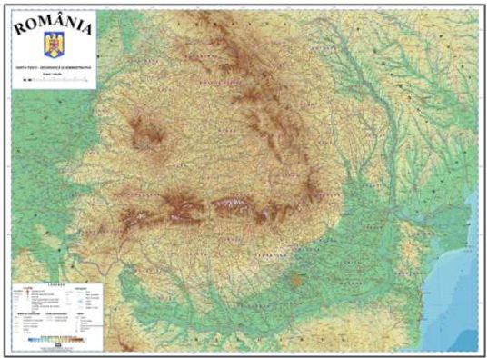
Map of Romania
Map type: Scanned mapsProduct name: Physical-Geographical and Administrative Map of Romania at a 1:500,000 Scale
Technical details
Format: TIFF
Map sheet dimensions: 55cm x 77.5 cm
Approximate ground dimensions corresponding to a map sheet: 275 km x 387.5 km
4
Map sheets
8
Color depth (bits)
2
Maximum file size (MB)
4
Map sheets
300
Scanning resolution (dpi)
Description / Method of acquisition
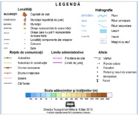
The map shows the boundaries of the counties, towns, national-level road and railway communication routes, and the main elements of the hydrographic network. The relief is represented using hypsometric shading, with a 17-step color range, which provides high expressiveness and ensures easy visualization and memorization of the geographical features and divisions of Romania’s territory.
The map measures 110 x 155 cm and is composed of four sheets.
The projection of the meridian and parallel grid, drawn on the map with a density of 1° and marked at the edges by segments with a value of 5’, ensures the rapid and accurate geographical positioning of each element within the content.
Dataset