Defense Geospatial Information Agency "Division General Constantin Barozzi"
Ministry of National Defense

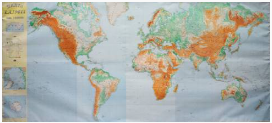
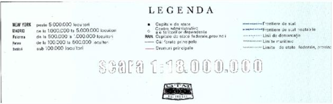
World Map at a 1:18,000,000 Scale
Map type: Scanned mapsProduct name: Political World Map at a 1:18,000,000 Scale

Technical details
4
Map sheets
8
Color depth (bits)
41
Maximum file size (MB)
4
Map sheets
300
Scanning resolution (dpi)
Description / Method of acquisition
The map represents the land area between the 80° North parallel and the 80° South parallel. The cartographic grid, consisting of projections of meridians and parallels, is drawn every 10° and is represented by curved lines, except for the Equator and the 40° East meridian, which are depicted as straight lines. Intermediate values of the cartographic grid, with a density of 12', are also marked on the map frame, allowing for more precise geographical positioning of the elements within the content.
Within the continental limits, the map shows the national borders of countries, capitals, and major towns, international railway and road communication routes, major rivers, lakes, and inland seas. It also provides detailed representations of islands, archipelagos, and main sea routes. The territories of countries are highlighted using background colors, chosen to ensure quick identification and delineation, as well as exceptional graphic aesthetics.
The map is composed of four equal-sized sheets, forming an assembly of 125 x 190 cm.
Dataset