Defense Geospatial Information Agency "Division General Constantin Barozzi"
Ministry of National Defense

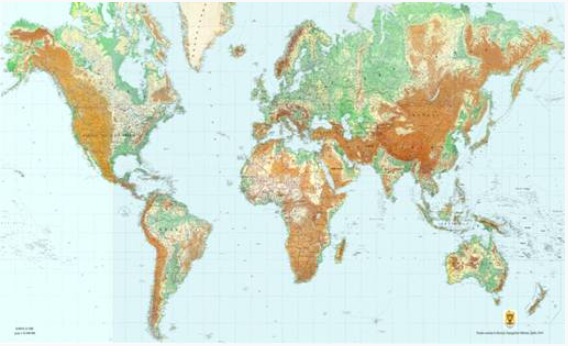
World Map at a 1:10,000,000 Scale
Map type: Scanned mapsProduct name: Physical-Geographical and Administrative World Map at a 1:10,000,000 Scale

Technical details
Projection: cilindrică dreaptă conformă Mercator
Format: JPEG
Map sheet dimensions: 85 cm x 75 cm
Approximate ground dimensions corresponding to a map sheet: 85.000 km x 75.000 km
10
Map sheets
8
Color depth (bits)
111
Maximum file size (MB)
10
Map sheets
300
Scanning resolution (dpi)
Description / Method of acquisition
The Physical-Geographical and Administrative World Map at a 1:10,000,000 scale illustrates the physical-geographical features of the continents, with the borders of countries, major towns, rivers, and communication routes of continental importance. The geographic grid is represented every 10°, ensuring the quick positioning of details within the content.
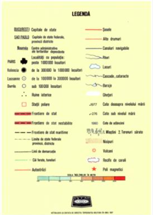
The map has dimensions of 170 x 385 cm, and is composed of 10 sheets, each measuring 85 x 75 cm, with an annex consisting of 2 sheets (format 35 x 85 cm) that can be mounted on the left or right side of the assembly. This annex represents the legend, the sheet layout, and the polar area maps in an azimuthal equal-area projection.
Dataset