Defense Geospatial Information Agency "Division General Constantin Barozzi"
Ministry of National Defense

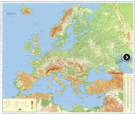
Europe Map at a 1:5,000,000 Scale
Map type: Scanned mapsProduct name: Physical-Geographical and Administrative Map of Europe at a 1:5,000,000 Scale

Technical details
Format: JPEG
2
Map sheets
8
Color depth (bits)
78
Maximum file size (MB)
2
Map sheets
300
Scanning resolution (dpi)
Description / Method of acquisition
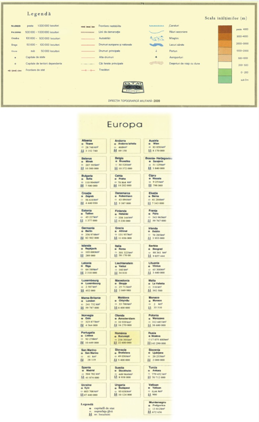
The Physical-Geographical and Administrative Map of Europe at a 1:5,000,000 scale was created by the Military Topographic Directorate "Major General Constantin Barozzi" in 1999 and revised in 2009. It consists of two map sheets, containing for each country physical-geographical details and administrative information regarding the capital, area, and population.
Dataset