Defense Geospatial Information Agency "Division General Constantin Barozzi"
Ministry of National Defense

Topographic Plan of Bucharest
Map type: Scanned mapsProduct name: Topographic Plan of Bucharest at a 1:15,000 Scale

Technical details
Description / Method of acquisition
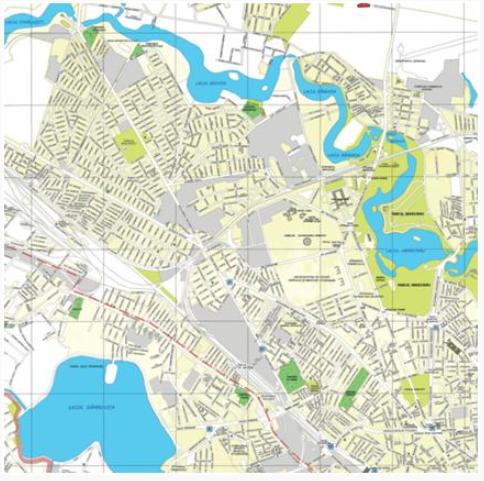
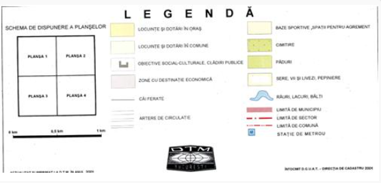
The Topographic Plan of Bucharest at a 1:15,000 scale was created based on topographic maps at scales of 1:5,000 and 1:10,000 through cartographic generalization. The plan consists of four sheets, each measuring 80 x 76 cm. The representation of the entire city, along with its suburban communes and villages, on a minimal number of sheets allows for an assembly of convenient dimensions, suitable for the overall study of the city, its expansion areas, and recreational zones. The generalized depiction of residential buildings and industrial areas, highlighted with soft contrasting colors, ensures high expressiveness and an aesthetically pleasing graphic appearance.
The informational content of the plan is enriched with the representation of buildings and places of social interest (parks, cemeteries, stadiums, markets, etc.), as well as details on administrative-territorial divisions.
The representation of all streets, along with the labeling of each with its respective name, ensures fast navigation and easy identification of any point or constituent element of Bucharest’s territory.
Dataset
