Defense Geospatial Information Agency "Division General Constantin Barozzi"
Ministry of National Defense


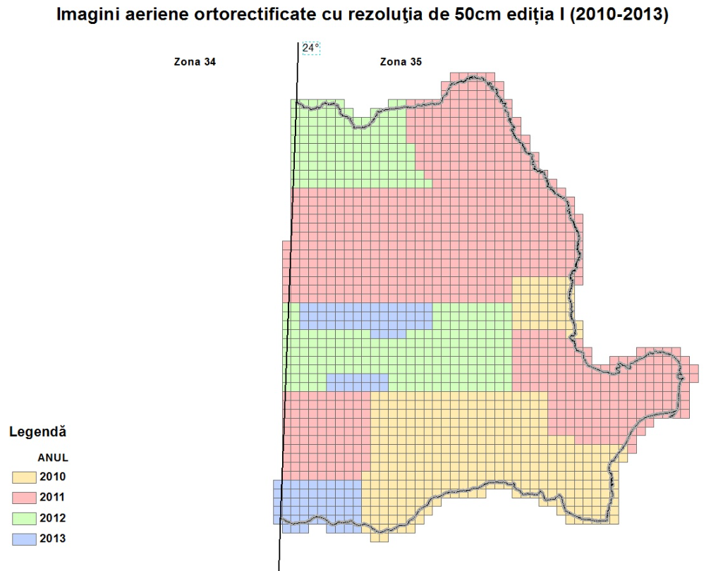
Grid of Orthorectified Aerial Images - Zone 35
Map type: IndexProduct name: Grid of Orthorectified Aerial Images with 50 cm Resolution, Edition I (2010-2013) - Zone 35
Technical details
The coordinate system in which they were created: WGS84 Coordinate System
Projection: UTM zone 35
Format: shapefile
Description / Method of acquisition
The grid contains the outlines of photogrammetric image sections for Zone 35.
The grid was created by drawing kilometric grid lines that divide the national territory into square sections measuring 10 x 10 km, starting with coordinate 250,000, increasing eastward, and coordinate 5,350,000, decreasing southward.
The name of each section is determined by the first two digits of the East coordinate and the first three digits of the North coordinate in the UTM Zone 35 projection for the top-left corner of the section.