Defense Geospatial Information Agency "Division General Constantin Barozzi"
Ministry of National Defense

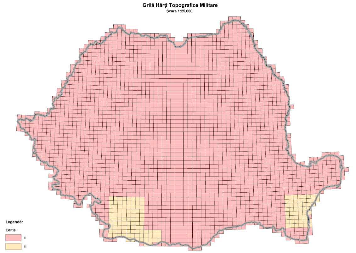
Grid of Military Topographic Maps at a 1:25,000 Scale, Stereo 1970
Map type: IndexProduct name: Grid of Military Topographic Maps at a 1:25,000 Scale
Technical details
The coordinate system in which they were created: 1942 Coordinate System
Projection: Stereo 1970
Format: shapefile
2822
Number of sections
503
Maximum file size (MB)
Attribute table description
The attribute table contains the following fields:
| # | Field name | Description |
|---|---|---|
| 1 | Nume | denumirea secțiunii |
| 2 | Ediție | ediția foii de hartă |
Description / Method of acquisition
The grid contains the outlines of the military topographic map sections at a 1:25,000 scale for the national level.
The grid was created by drawing geographical grid lines that divide the national territory into sections with 5' latitude and 7' 30" longitude on the Krasovsky ellipsoid.
Each map sheet is uniquely identified by its nomenclature.