Defense Geospatial Information Agency "Division General Constantin Barozzi"
Ministry of National Defense


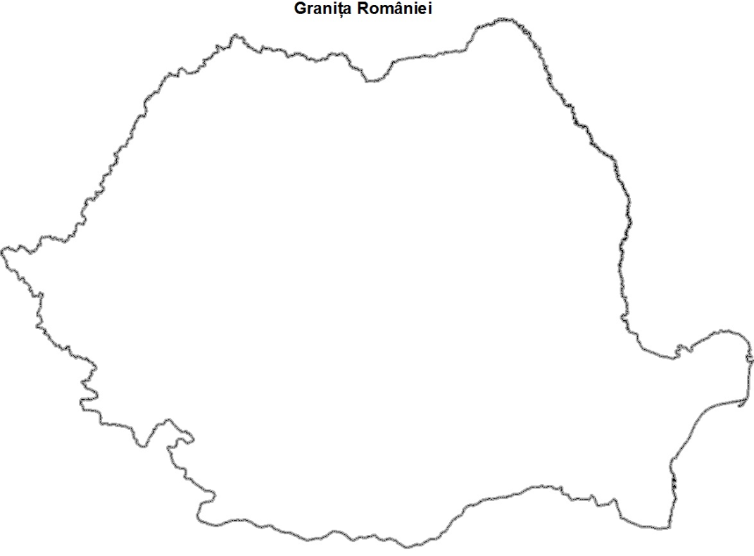
The Border of Romania
Map type: Vector dataProduct name: The Border of Romania
Technical details
311
Maximum file size (MB)
Description / Method of acquisition
The file contains the outline of Romania based on the following documents:
For Bulgaria: The documents of the "Craiova Treaty of September 7, 1940" are used, as follows: for the land sector from the Boundary Register of the Craiova Treaty, and for the sector on the Danube River through digitization from maps at a scale of 1:60,000 and topographic plans at a scale of 1:10,000. The precision of the coordinates of the digitized points along the Danube River in the Romanian-Bulgarian border area is estimated at approximately 10 meters.
For Serbia: The documents from the Treaty of Sèvres of August 10, 1920, as well as a series of protocols concluded during the execution of hydromelioration works in the Iron Gates area.
For Hungary: For the water sectors, according to the minutes of the border commissioners "The border line established based on joint control at the Romanian-Hungarian state border in 2006 on the unregulated course of the Mureș River and in 2007 on the Crișul Negru and Tur rivers, in the border sections A, D, and L" signed on October 13, 2010, at Borș, and for the other sections according to bilateral documents signed after the peace treaties of Trianon (June 4, 1920) and Paris (February 10, 1947).
For Ukraine: According to the minutes signed within the Romanian-Ukrainian Joint Border Commission between 2010-2013 (documents not ratified at the government level) except for the border markers 661-666 (Suceava River) and 1408-1411 (Maican Island on the Danube), sectors still unagreed at the Joint Commission level, where the border line was collected by digitization from the military topographic map at a scale of 1:25,000 (created in 1985 for the Suceava River sector and 1980 for the Maican Island sector).
For the Republic of Moldova: According to the "Treaty between the Government of the People's Republic of Romania and the Government of the Union of Soviet Socialist Republics regarding the state border regime between Romania and the Soviet Union, cooperation, and mutual assistance in border issues" signed in Bucharest on February 27, 1961, as well as the redeterminations of 1973 and 1975. For more accurate representation of the state border on the Prut River, intermediate points were digitized from topographic plans at a scale of 1:10,000 and 1:5,000. The relative precision of the border point coordinates is 2 meters along the entire segment.
For the Black Sea sector: Through digitization from aerial and satellite images from the period 2003-2006.
Dataset
The Border of Romania[shp]