Defense Geospatial Information Agency "Division General Constantin Barozzi"
Ministry of National Defense


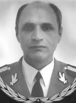
CORNELIU-GHEORGHE SEREDIUC
Colonel Doctor, Engineer - 2000-2002 - Commander of the Research and Design-Production Institute in the Field of Military Topogeodesy
Colonel Doctor Engineer - 2002 - Acting Chief of the Military Topographic Directorate
GHEORGHE-CORNELIU SEREDIUC was born on March 27, 1952, in the village of Corni, Botoșani County.
He attended primary school in the village of Corni until 1967, then continued his education at the General Culture High School in Truşeşti, Botoșani County, graduating in 1971.
In 1978, he graduated from the Military Technical Academy, Department of Construction, specializing in Geodesy, as valedictorian.
Between 1978 and 1981, he worked in the Control and Research Laboratory within the Cartography and Photogrammetry Unit.
In parallel with his military career, in 1979, he began studies at the Faculty of Mathematics at the University of Bucharest, which he completed in 1984.
From 1981 to 1990, he worked as an analyst-programmer at the Computing Office of the Military Topographic Directorate.
In 1988, he attended a postgraduate course in geodesy and military topography at the Military Technical Academy.
In 1996, he obtained his PhD in Geodesy, Cartography, Photogrammetry, and Remote Sensing with the thesis "Contributions to the Application of Numerical Methods for Determining the Geoid" from the Military Technical Academy.
In 1990, he became a lecturer at the Military Technical Academy, advancing to associate professor in 1997 and then full professor in 1999, teaching physical geodesy.
Between 1990 and 2000, he taught at the Faculty of Engineering, Geodesy, and Construction, as well as the Faculty of Armament, Ammunition, Missiles, and Engineering at the Military Technical Academy.
From 1995 to 1998, he served as head of the Department of Geodesy and Construction, and from 1998 to 2000, he led the Topogeodesy Teaching Commission. He was also a member of the Faculty Council, the Senate, and a specialist reviewer in doctoral committees.
Throughout his career, he published a university textbook, 17 scientific research papers, and 35 scientific communications, which were featured in specialized journals and the proceedings of national and international scientific conferences.
Between March 2000 and April 2002, he was appointed Commander of the Research and Design-Production Institute in the Field of Military Topogeodesy, subordinated to the Military Topographic Directorate.
On April 15, 2002, he was appointed Deputy Head of the Military Topographic Directorate, a position he held until November 2002, when he was retired. Between April 15, 2002, and July 31, 2002, he was also authorized to act as Head of the Military Topographic Directorate.
From November 2002 to March 2003, he served as Director-General of the Institute of Cadastre, Geodesy, Photogrammetry, and Cartography, while also working as a senior public official (senior advisor) within the National Cadastre, Geodesy, and Cartography Office until October 2004.